Mine workings around Kettlewell
The pages below are under development and will be updated on a regular basis.
Old mine workings are often frequented by bats. All bats are protected by law and must not be disturbed under any circumstances.
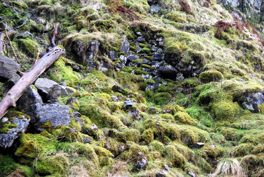
The mine workings of this area have been abandoned for up to 150 years and are often in an extremely parlous state. Miners' waste was often stacked on timbers now in an advanced state of decomposition and these mines may contain pockets of dangerous gases.
Click on pictures for larger view: use back arrow for return
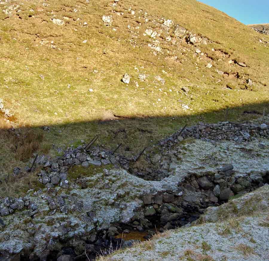
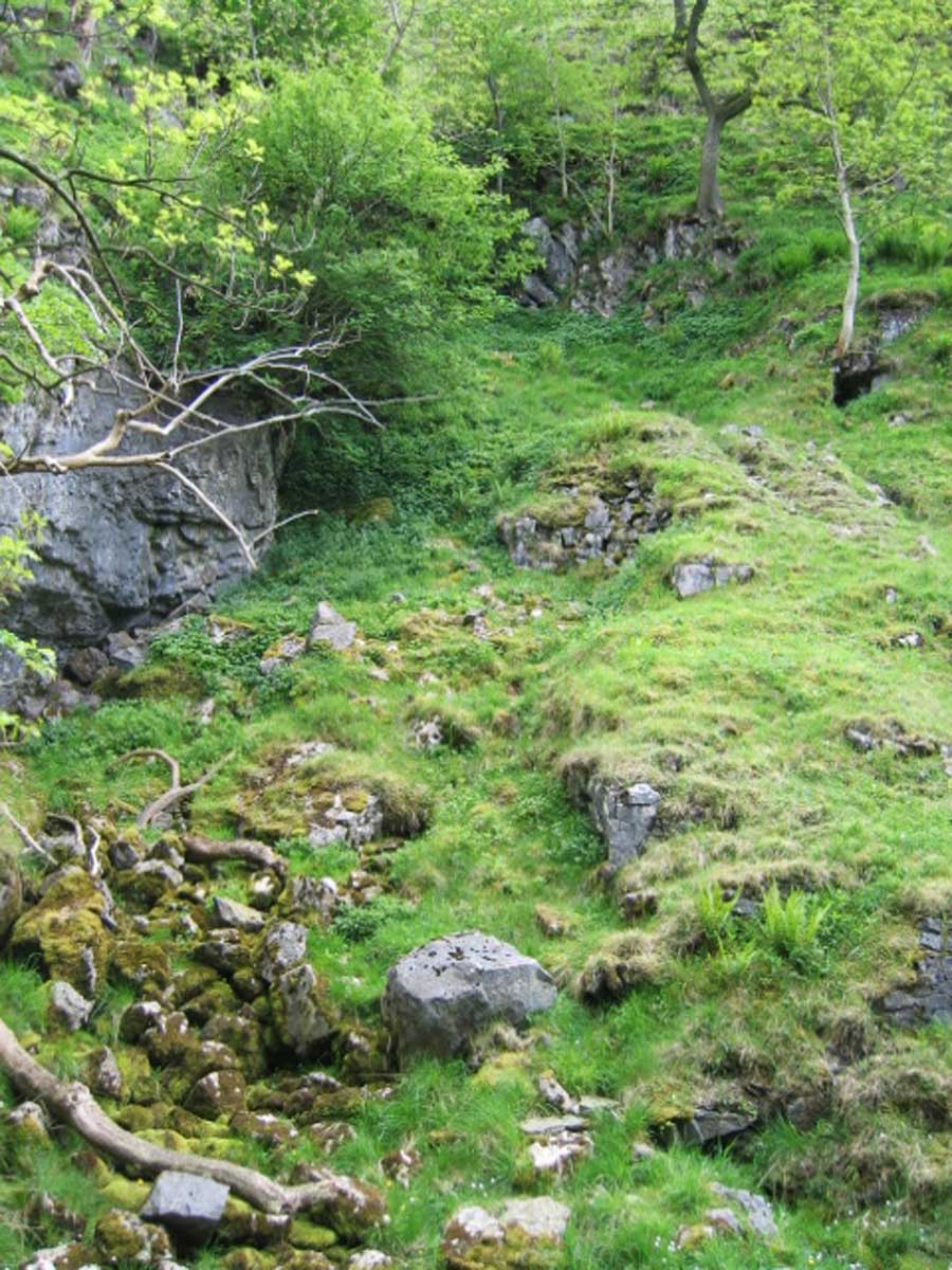
Providence Mine, Middle Level and Lower Level
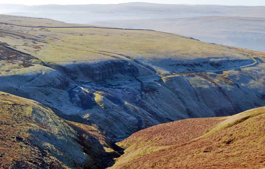
Left: Old Providence Mine at the head of Dowber Gill. Middle Level is situated at the head of the waste-heaps to the left of the scar. February 17 2008
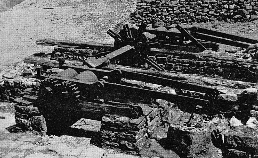
Right: Remains of the crushing plant at Old Providence Mine in the early 1950's. Photo: source unknown
A water course, or aqueduct, locally known as a leat, can be seen which would have brought a stream of water from springs around the moor from the right of the picture. This water supply was used to drive a water wheel which powered an ore crushing mill.
The surviving parts of the mill were rescued by the Earby Mines Research Group in 1960 and are now on view at the Earby Mines Museum. Other mining relics can be seen at Skipton museum. The mines of this area were worked almost exclusively for the lead ore, galena.
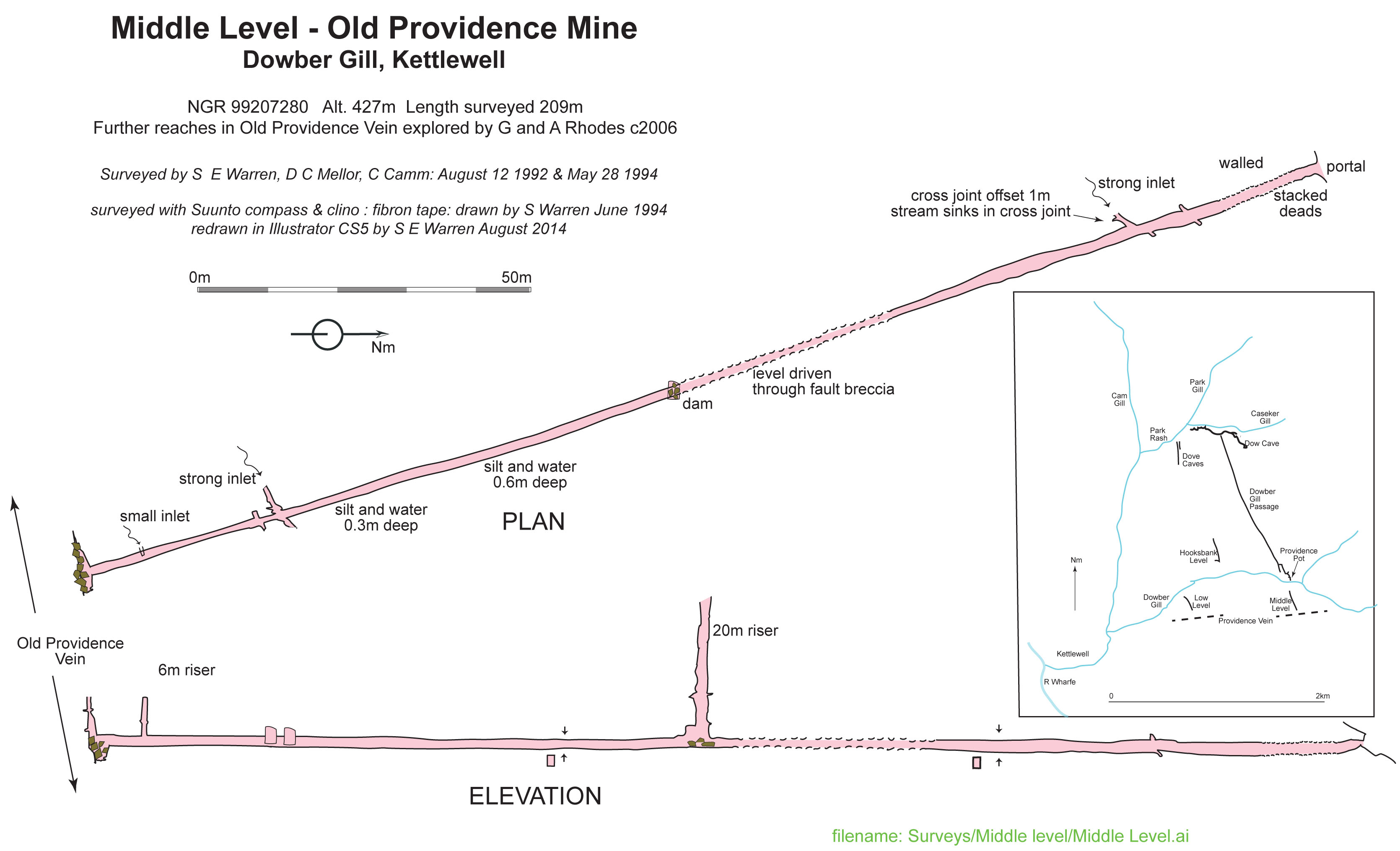
Plan and elevation Middle Level, Providence Mine. Surveyed by S E Warren, D C Mellor and C Camm, June 1994
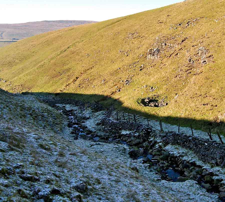
The Old Providence Mine worked the Providence Vein, a relatively productive vein running approximately east-west a little to the south of Dowber Gill. Several other lesser veins were worked around the Dowber Gill area.
The veins were worked from Lower Level further down Dowber Gill, from Middle Level, from Upper Level and from a number of shafts immediately above the vein. Further information can be found in Raistrick 1973 "Lead Mining in the Mid Pennines"
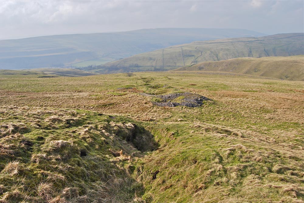
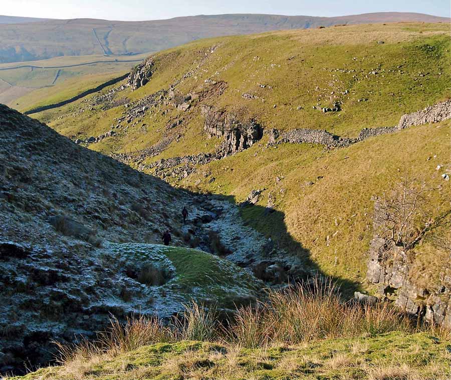
Right:
Line of shafts on the Providence Vein on the south side of Dowber Gill
March 2 2012
Dove Caves, Upper and Lower
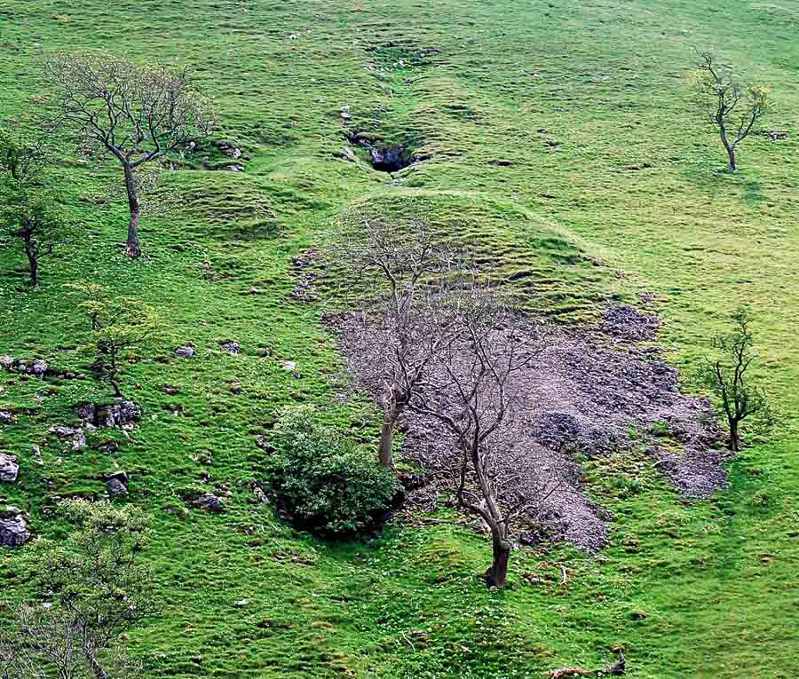

The small mine workings known as Dove Caves Upper and Lower were re-discovered by members of the British Speleological Association in the 1950's having been abandoned by the miners of perhaps the mid-19th century. The size of the spoil heap is a good guide to the extent of the workings and in this case some 180m or so for the Upper level. May 25 2009
Right: Upper Dove Cave entrance, located at the head of the large spoil heap in the picture to the left. October 15 2011
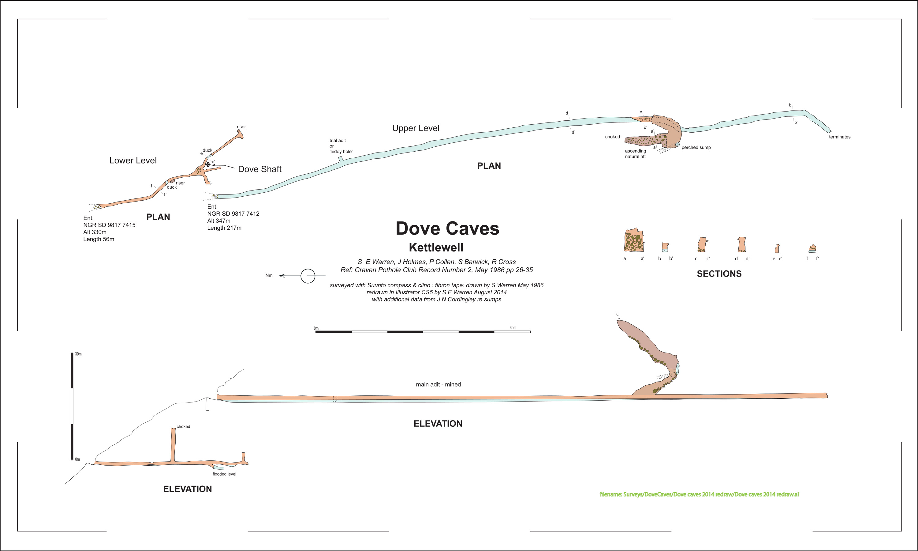
Sketch plan of Dove Caves. Surveyed by S E Warren, J Holmes, S Barwick, R Cross, and P Collen April 1986. Redrawn S E Warren 2014
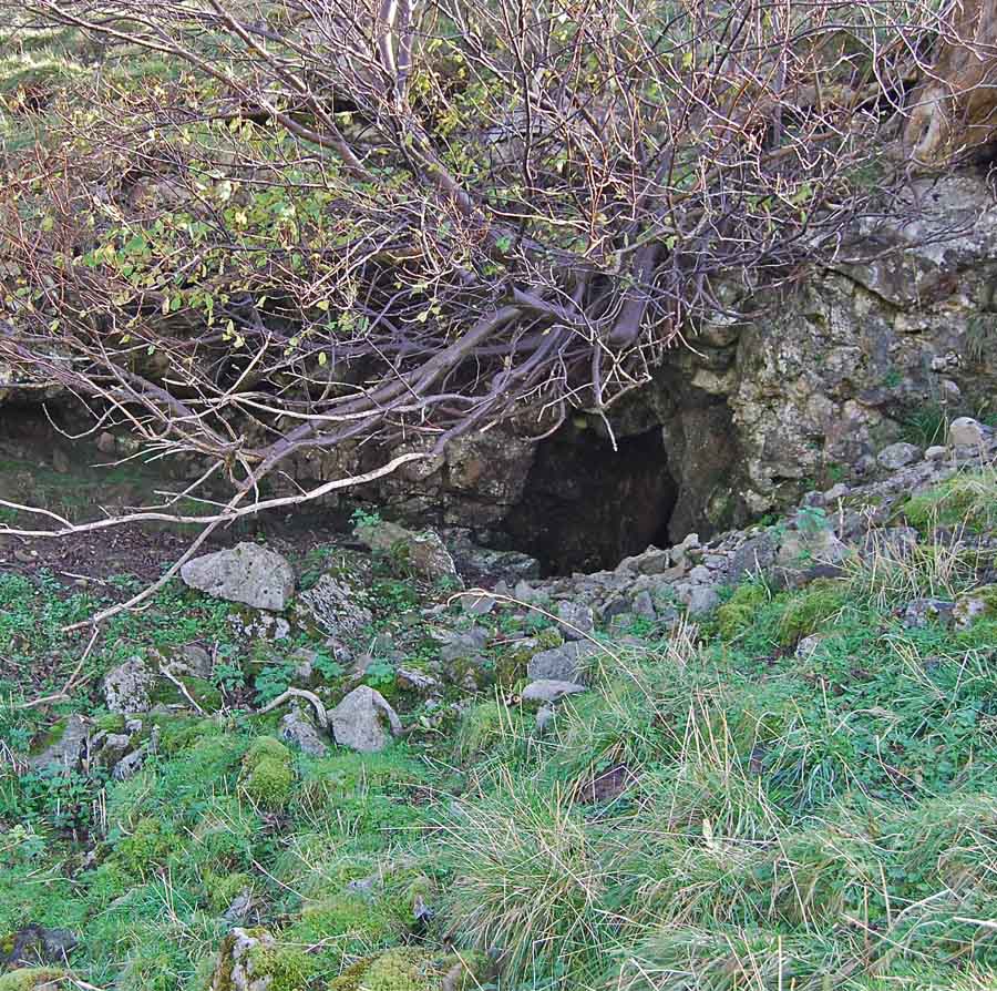
Left: Lower Dove Cave entrance, located under the bush to the left of the trees in the picture above. Photo SEW October 15 2011
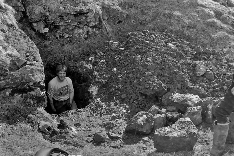
Right: Dove Shaft, a choked mine shaft of unknown original depth was excavated to 6m by Damion Teale (pictured) and Don Mellor in 1986. The shaft is located immediately to the left of Upper Dove Cave on the picture above. April 2 1986.
Dove Cave Upper and Lower are the names thought to have been given when they were explored by the BSA members in the 1950's but in fact they are small mine levels which broke into natural cavities.
The upper level takes the usual form for a mine level although somewhat choked with an accumulation of mud and rock washed down from the adjacent slopes. This forms a small dam holding back a metre or so of water which decreases in depth further into the level. A walking size passage passes a small side trial at 50m and, as the floor rises little at 120m, a steeply ascending natural cavity is encountered. Rising some 15m at a steep angle this is richly decorated with calcite deposits and great care is needed to avoid disturbing them. The level continues for a further 40m to a blank wall. A perched sump in the upper part was dived by John Cordingley in 1986 with no progress being made.
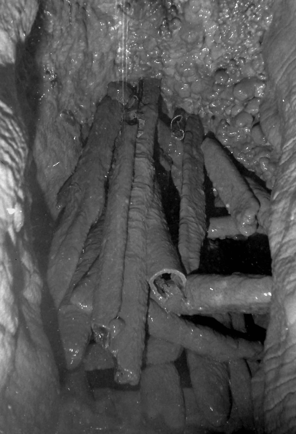
The lower entrance is obscured by vegetation and is of much smaller dimensions. After some 20m a blind riser to one side goes up approximately 10m. A little further in deep water is encountered neccessitating almost total immersion in a low duck through to a natural cavity festooned with calcite depositions. Any possible continuation beyond this point is unlikely. A well calcited ancient stack of stemples or pipes forms a very attractive feature once described as 'the best value per foot-length in the Dales'.
Above
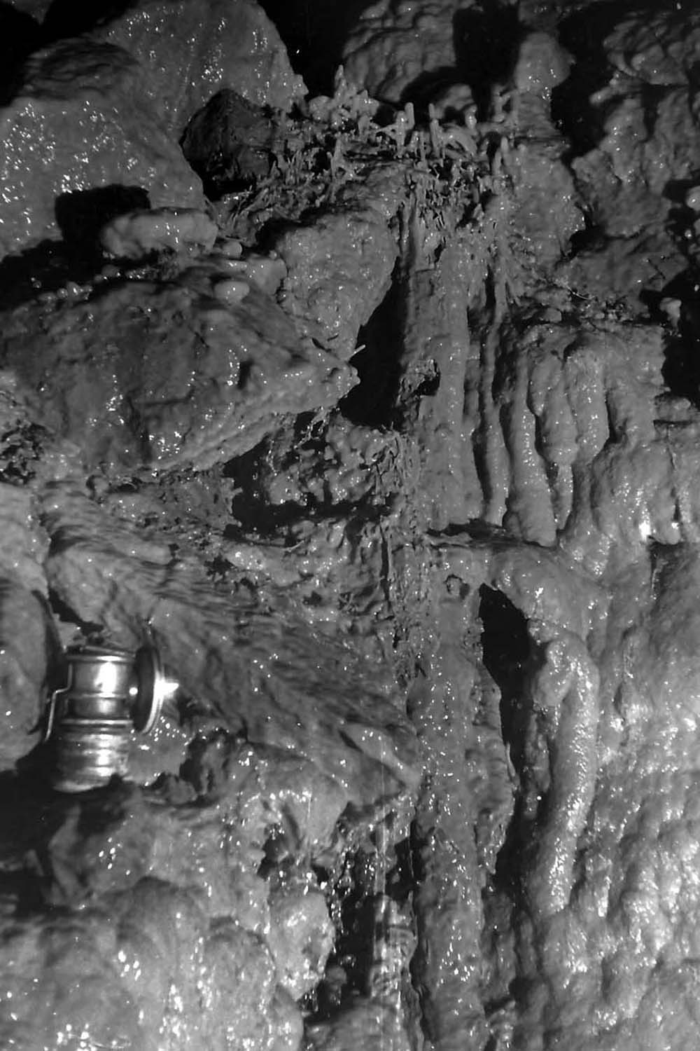
left: calcited artifacts in Lower Dove Cave, Photo SEW April 2 1986.
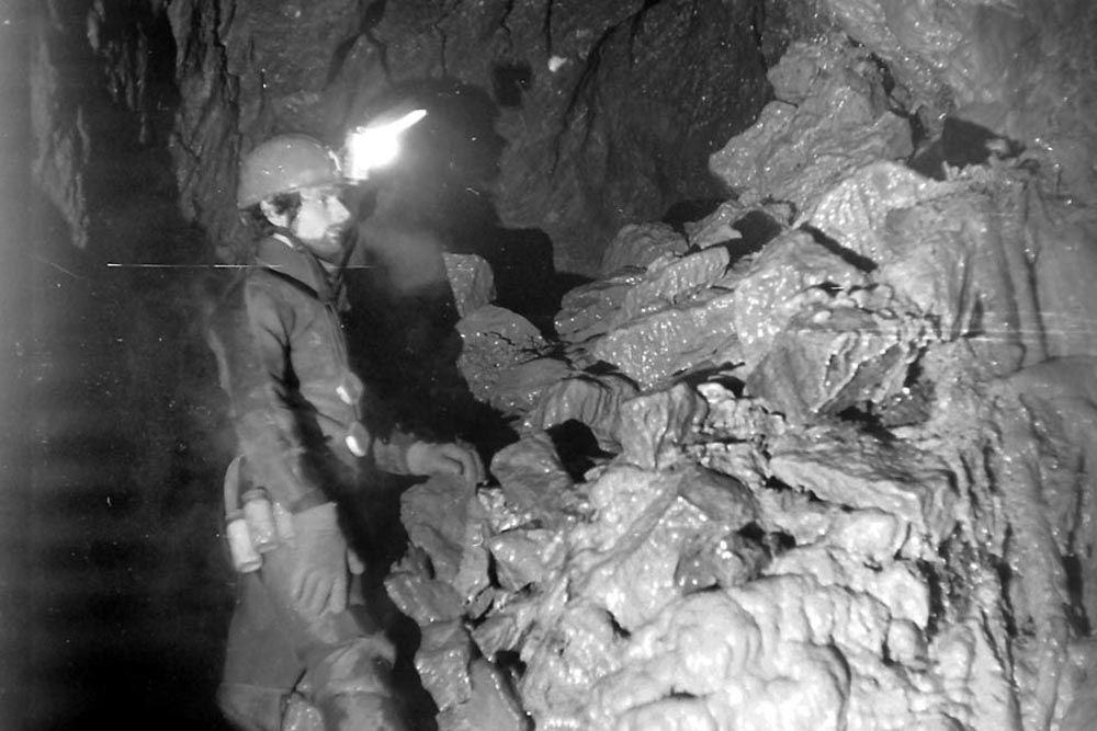
Above centre: John Holmes in Upper Dove Cave. Photo SEW March 30 1986.
Above right: calcited timbers in Lower Dove Cave. Photo. April 2 1986
Hooksbank Mines
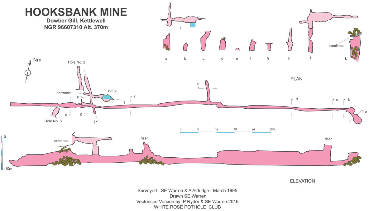
Plan and elevation Hooksbank Mine, Surveyed by S E Warren and A Aldridge, August 25 1987
Mines of Caseker Gill
Abandoned
mine shaft (Shaft A) in Caseker Gill (98769 74329 384m). On June 5
2012 a 'radio-location' by Andy Cole, Alan Scowcroft and the writer showed this shaft to connect with the 'ladder'
riser in
Rattle and Sploosh series in Dow Cave. The vertical separation is
likely to be in the order of 10 - 15 metres. Note
the dip of the faulted limestone above. Shaft B is upper right.
February 17 2008.
Abandoned
mine shaft (Shaft B) (98786 74327 389m) in Caseker Gill. Shaft A is by the fence in the
shade.
February 17 2008.
Upper
Caseker Gill, from above outcrop of Middle Limestone. Note line of
shafts along old wall in middle ground, aligned on 80 degrees on same
line as Shafts A and B further down the gill.
May 1987. According to Mike Gill these diggings, along with those known as Dove Caves (see above), were worked as the Victoria Mine before 1850. (British Mining No. 49: The Wharfedale Mines: M C Gill 1994). Thanks to Adele Ward for unearthing this information.
Higher
up Caseker Gill, by the final confluence of tributaries, there is yet
another shaft which seems to be unrelated to the lower shafts.
February 17 2008
Mine workings of Dow Cave
Left: just below the entrance to Dow Cave there is a miners' 'bingstead' or 'bouseteam' into which the miners' ore-bearing rock would be tipped for storage and later breaking up and sorting. April 31 2004.
Right: closer view of the bingstead outside Dow Cave. March 1 2009.
From this it seems clear that the miners brought ore out of the cave entrance. There is no indication of how much ore was brought out this way. The bingstead is unlikely to have been built any later than 1850, and probably somewhat earlier.
This suggests that the entrance to Dow Cave collapsed from a wide open arch to the present choke of fallen rock at a much earlier time. This contradicts one theory: that the entrance to Dow Cave collapsed in late Victorian times.
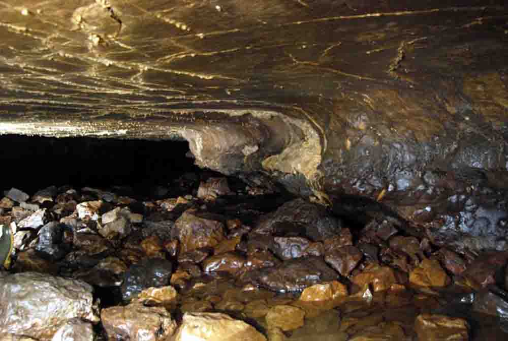
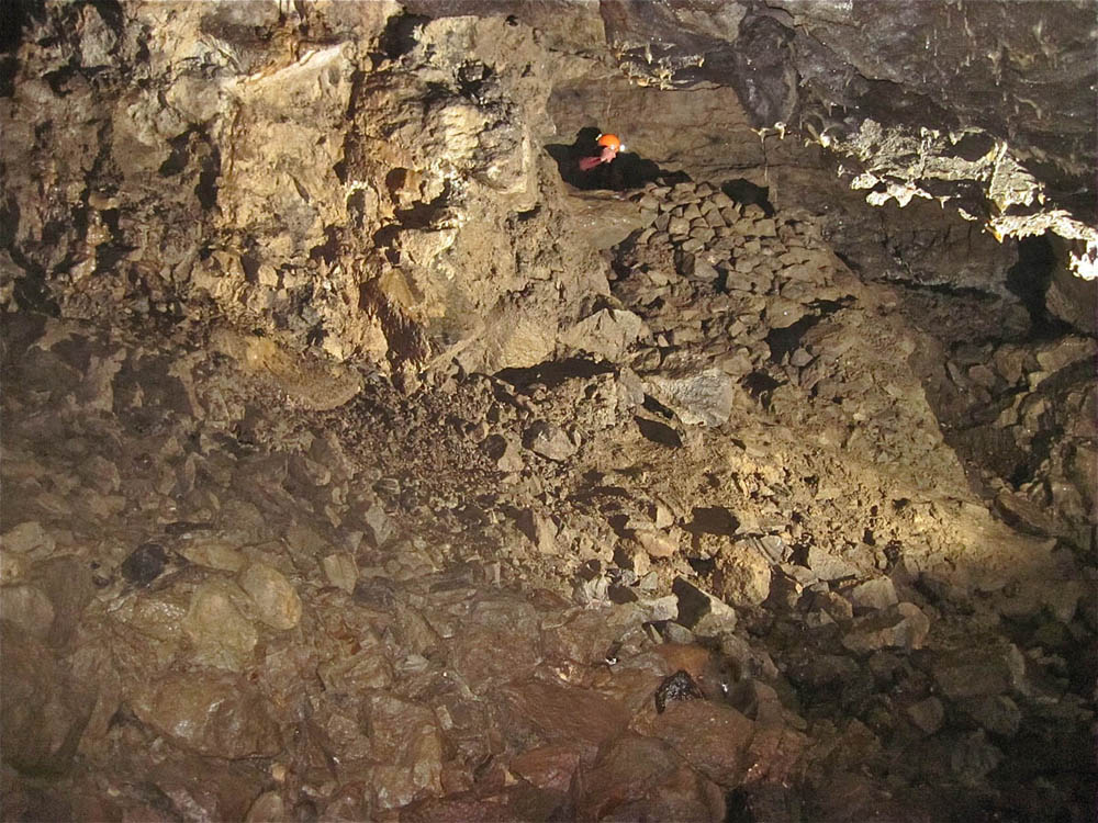
"Treacle Mine": this is found at a point where a section of roof breakdown occurs due to intersection of the main passage with a mineralised fault line. Stacks of miners' deads, a short level into a stoped area, and a 10m riser were left by the miners.
The riser probably connected with one shaft of a line of shafts on a 80 degree trend on the surface immediately above.
Phil Ryder at the approach to the "Treacle Mine" from the Main Streamway. Photo SEW April 5 2009
The Treacle Mine area viewed from upstream side showing the nature of the breakdown along a fault - Phil has his back to the fault line. Photo SEW April 5 2009
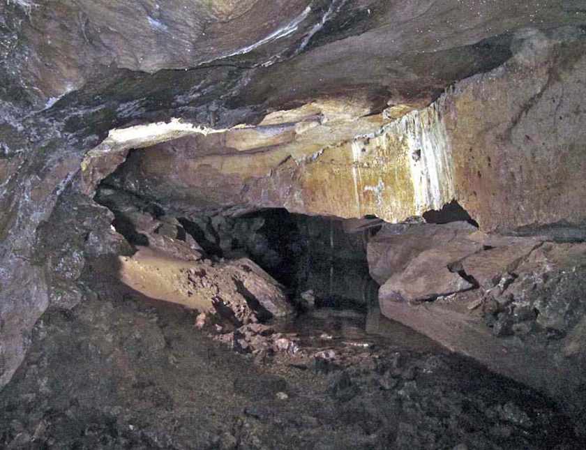
A rarely seen part of Dow Cave where the stream has carved a new route under the breakdown zone of the "Treacle Mine". Photo SEW April 5 2009
Immediately after the Treacle Mine collapse a mineralised fault line is obvious in the roof. Whilst the passage side to the right (south) has a conventional stream passage form, breakdown from the roof to the left (north) has infilled any canyon that may have pre-existed. To the left of the picture, the mud slope leads up into Gloop-de-Loop. Photo SEW September 26 2010
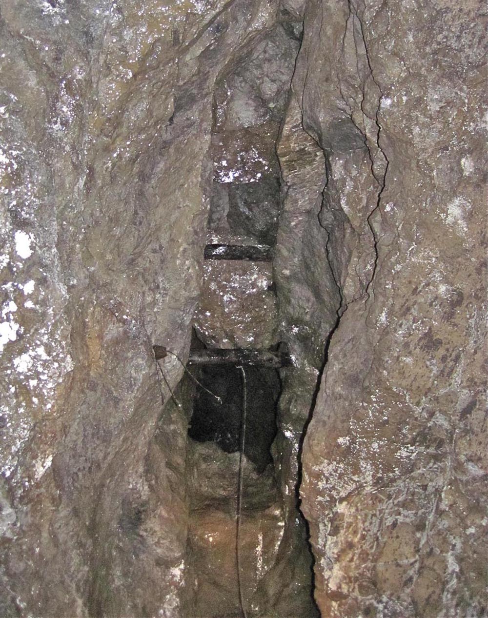
"Dribble Mine": two holes in the roof of the main streamway immediately above the entrance to Dowber Gill Passage open into Dribble Mine. The left hand picture shows the larger of the two and also the perilous nature of the old stempling. Aligned along the same 80 degrees as other mined areas, Dribble Mine extends over a distance of some 50m with a vertical range of 13m. Access to the workings is by a riser at the opposite side of the main cave passage to the Dowber Gill Passage entrance.
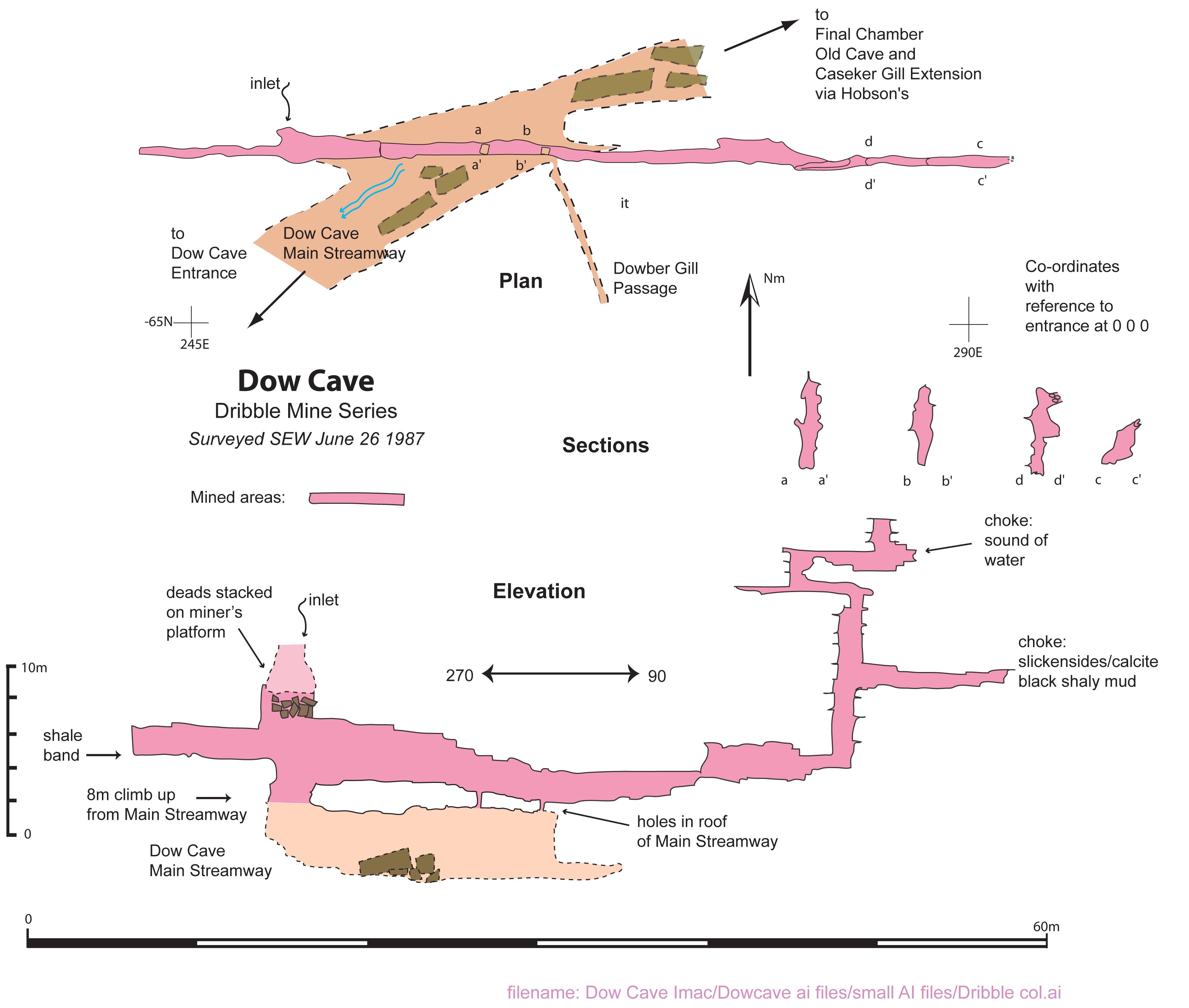
Sketch plan and elevation of Dribble Mine, Surveyed by S E Warren June 22, 1987
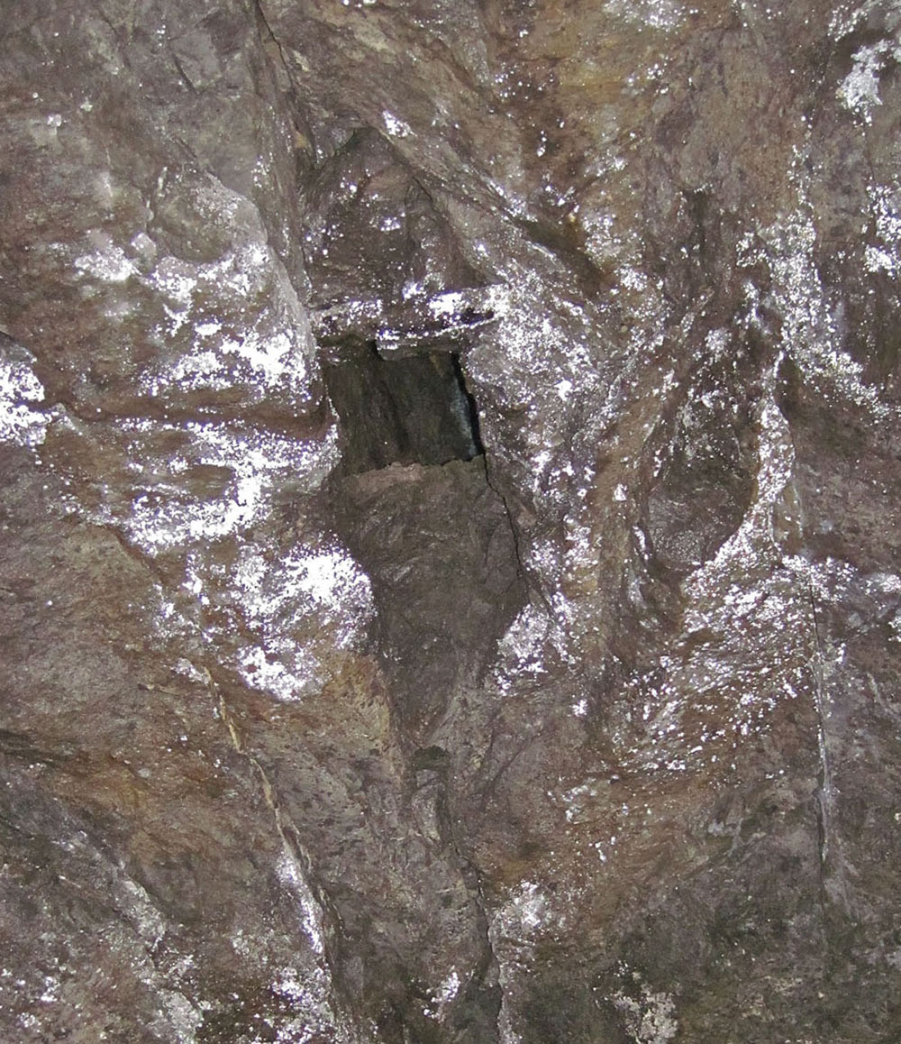
"Stemple Rift Mine Series": a treacherous climb up a narrow rift on the east corner of Third Miners Chamber leads into an obscure and rarely-visited part of Dow Cave. Immediately at the top of the climb is a second climb up to a miners sump (a small flooded shaft) and a mined passage similar to the Dribble Mine workings. In addition a low boulder choked passage heads in the direction of Clog's Way.
Aligned along the same 80 degrees as other mined areas, the Stemple Rift Mine Series extends over a distance of some 60m with a vertical range of 15m.
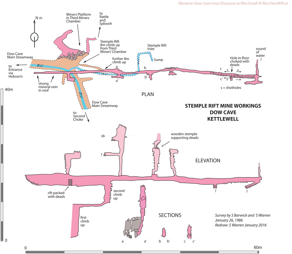
Sketch plan and elevation of Stemple Rift Mine Series, Surveyed by S E Warren and S Barwick January 26, 1987
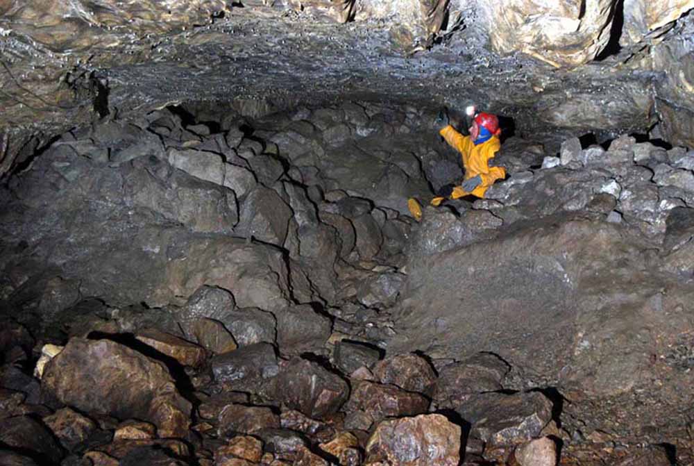
"Rattle
and Sploosh": the
parts of Dow Cave known as 'Rattle and Sploosh' comprise a series of
mined passages accessed from inside the cave at the Third Miners'
Chamber and also from the surface at Shaft A (see photograph
above).
Below left: Andy
Cole high up on the Miners' Platform in the Third
Miners' Chamber.
June
5 2012.
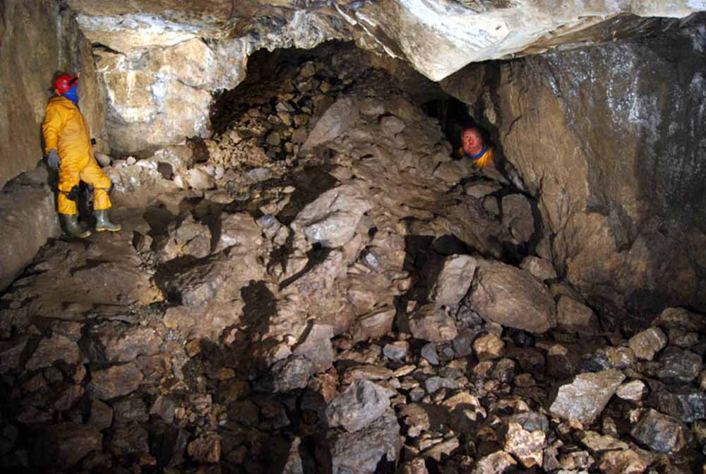
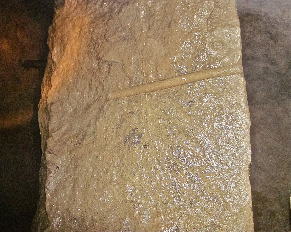
Below
centre shows a drill hole clearly drilled from the bottom
of the shaft in the direction of the cave. The implication is
that that the miners first explored the mineralisation from the
surface.
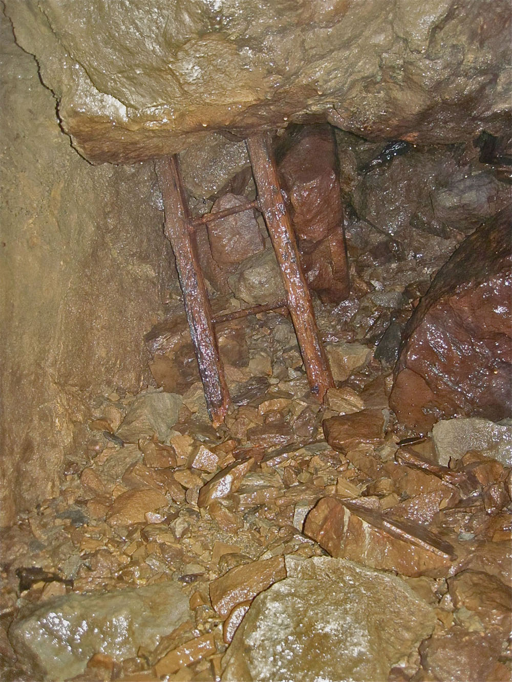
Below right:
the remains of a miners' ladder in a
choked riser that has now
been shown to be located directly below Shaft A on the
surface. June
5 2012
Adjacent areas
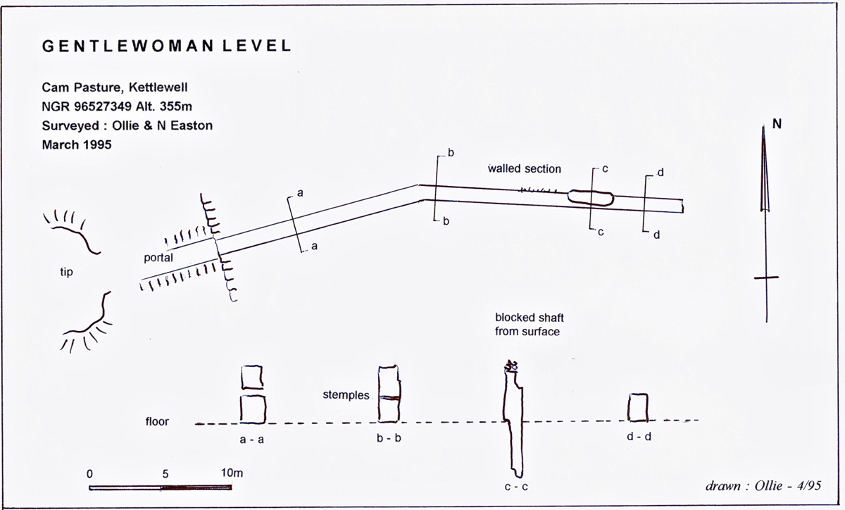
Sketch plan Gentlewoman Level, Cam Pasture, Surveyed by A Aldridge and N Easton, March 1995
Any
shortcomings in the text are entirely my own.
If you would like to get in touch or add information, there is an email
address:
mudinmyhair@btinternet.com
Steve Warren
Website
created by WarrenAssociates 2012
Website hosted by Tsohost
Copyright © Steve Warren 2012